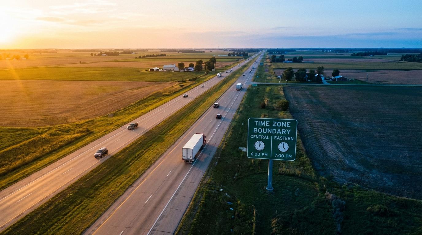
Interstate 65 crosses from Central to Eastern time somewhere in the flat farm country between Gary and Lafayette, and the first time I drove it with navigation running, our arrival time jumped forward by an hour. My friend in the passenger seat was reading the screen, and she announced that we had somehow lost an hour without stopping. Nothing had gone wrong with the route or the car. The app had simply started printing our arrival in Eastern time instead of the Central time we left behind in Gary, and it took me most of the way to Lafayette to work out why that was the only thing that changed.
The explanation turned out to be more interesting than the glitch I assumed it was, mostly because the part of your phone that figures out where you are has no idea what time zone you’re in.
GPS runs on a clock nobody sets their watch to
GPS satellites broadcast timestamps in GPS Time, a continuous count that started in January 1980 and has never been reset. It skips nothing for daylight saving, and it ignores leap seconds as well, which is why GPS Time and the UTC your phone displays have drifted apart by a handful of seconds over the decades (receivers apply the offset, so you never see it). There are no zones in it. Every satellite is counting the same number upward at the same moment, and your phone works out its position from how long each signal took to arrive, measured against that count.
Turning that count into the clock you read happens at the very end, and it leans on something most people have never heard of: the IANA time zone database. It’s a plain text collection of every time zone rule on Earth, historical ones included, like the years when individual Indiana counties chose their own clocks, and a copy of it ships inside nearly every phone and server. A tiny group of volunteers maintains it (for long stretches, mostly one coordinator working through a mailing list), and when a government changes its rules, someone has to notice and edit the file before the update can reach anyone’s phone. Your phone uses the cell network or its location to decide which zone you’re standing in, then formats the moment with that zone’s rules into the time on your lock screen.
Where the jump comes from
An app that shows arrival as a clock time does a small sum. It adds the travel time left, which comes from road speeds the map provider knows about (how map providers collect that road data is a rabbit hole of its own), to the current moment and formats the result in some time zone. The only real decision is which zone to print it in. Mine back then used whatever zone the phone was in. Before the county line the phone said Central and the arrival read one way, and after it the phone switched to Eastern and printed the same arrival moment an hour later. We hadn’t gained or lost a minute of driving.
Some apps format the arrival in the destination’s zone instead, so it reads the same on both sides of the line and matches the clock on the wall when you pull in. That’s the version I prefer for a single car. It gets awkward when the destination sits in a different zone from the start, because the arrival you see doesn’t line up with the clock on your dashboard and someone has to do the conversion in their head.
Dispatch screens make it worse
Take a truck running from Chicago to Boston on I-90. The route crosses exactly one time zone line, in northern Indiana before South Bend, but if the dispatch screen shows each driver’s arrival in the driver’s current local time, the estimate moves an hour later the moment the truck rolls into Eastern time. Nothing about the load or the pace changed. A dispatcher who isn’t thinking about time zones sees an hour appear out of nowhere and calls to ask where he stopped, and the driver ends up explaining a county line at the next fuel stop.
Samoa lost a Friday
Bigger jumps work the same way. The International Date Line is a political line drawn through the Pacific and bent around island groups so nobody has to live on two dates at once, and GPS Time has no idea it exists. Cross it on a ship and the calendar on your phone moves a full day while the receiver keeps counting without a hiccup.
Where it does get messy is in the rules file. In 2011 Samoa moved itself to the other side of the date line and skipped a Friday entirely, going from Thursday straight to Saturday. Egypt has switched daylight saving off and on again several times since then, once with only days of warning. If a phone hasn’t installed an update in a long time, its copy of the database can fall behind, and the clock it shows will be off by an hour even though the position fix underneath is fine.
I find it oddly relaxing that the most accurate clocks most of us ever rely on are sitting in orbit with no opinion about daylight saving.
What a group sees in Konvoyage
Group trips add a twist, because several phones are involved and some of the people watching aren’t in the car at all. In the Konvoyage member list, nobody’s arrival is shown as a clock time. You see how long each person has left, in hours and minutes, next to how far away they are, and a duration doesn’t have a time zone, so when the lead car crosses into Eastern and the car behind hasn’t yet, neither number jumps by an hour. The “last seen” part is relative too, a few minutes ago rather than a timestamp. For a group, that’s the useful form of real-time ETA tracking anyway, since the question in the car is usually how much longer the others will be.
The live view link works differently, and I think it’s the right call. Anyone in the trip can share a link that opens in a browser, and the person watching sees each driver’s arrival as a clock time. That time is worked out by the viewer’s own browser, in whatever zone their computer or phone is set to. If my mother in Denver watches us drive from Chicago to Indianapolis, she sees our arrival in Mountain time, which is the number she wants when she’s deciding when to call. Someone waiting at the destination sees it in Eastern, because that’s where their phone is.
The map side never touches local time at all, since dots are placed from coordinates. A group map has quirks of its own (I wrote about dots disappearing when you zoom out), but clocks aren’t among them.
Next time you cross a line with a passenger reading out the arrival, which clock would you want it shown in, the one in the car or the one where you’re going?