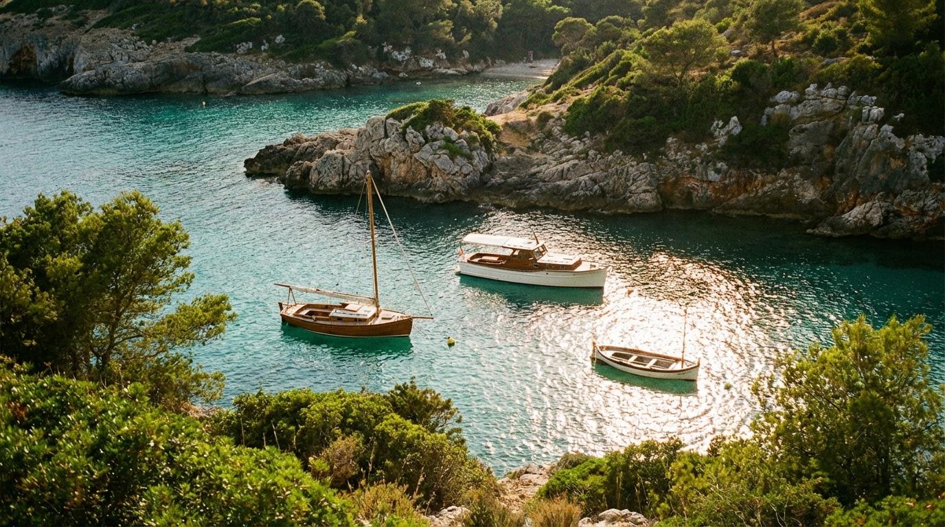
Sounds carry differently across water, and you notice it most when you’re idling three boats outside a channel marker, engines burbling at different pitches, the VHF crackling with half-conversations from other skippers somewhere beyond the point. You can hear the water slapping fiberglass, the gulls working a bait ball near the rocks, and somewhere behind all of it, the low hum of your friend’s outboard because she keeps forgetting to drop her revs when you’re all just sitting there, waiting to move together. That moment before the group push into a cove you’ve never entered is when things get interesting, because now you’re not just navigating for yourself.
You’re navigating for a small fleet.
Everyone Needs Their Own Chart
I used to think group boat navigation was simple. Lead boat picks the line, everyone else follows, single file, like ducklings, and it felt efficient and safe enough that I never questioned it. Then I watched an episode of Sailing Uma on YouTube where they talked about navigating unfamiliar passages with other cruisers, and something shifted in how I understood the whole practice. The part that stuck was their emphasis on each vessel knowing its own draft limitations, its own clearance needs, its own relationship with the bottom contour of whatever waterway it was entering. Following the lead boat assumes every hull draws the same water, and that assumption nearly cost me a friend’s lower unit on a trip through a rocky shelf near Islamorada, where my center console cleared with room to spare but her deeper-V pontoon did not share that luxury. She caught the rocks at low speed, thankfully, but the scraping sound traveled across the water like a scream.
After that, I stopped treating follow-the-leader as a navigation strategy.
Marine GPS units handle this better than most people realize, because a dedicated chartplotter shows depth contours, hazard markers, and your precise track overlaid on the chart in a way that a smartphone map simply cannot replicate with the same reliability. Smartphone apps like Navionics and iNavX have gotten genuinely good, and for fair-weather coastal cruising they can work, but they drain batteries fast, they lose signal in ways that dedicated marine units do not, and they lack the ruggedized mounting that lets you glance down at your course without reaching for a device that might bounce overboard in a wake. When you’re running three boats into a cove with a narrow entrance, you want every skipper looking at real-time depth under their own keel, not squinting at a phone in a waterproof case that fogged up an hour ago.
A harbor master I spoke with in Beaufort, South Carolina, a man named Dale who has spent three decades guiding boats through tight waterways along the Intracoastal, put it plainly. “When I see a group of recreational boats coming through a narrow cut, the ones that get into trouble are always the ones where only the first boat has a plan,” he said. “Every captain needs to know what’s under them, not just what’s in front of the boat ahead.” He told me he’s pulled boats off sandbars where the skipper’s entire navigation strategy was keeping the stern of the lead vessel in sight. That approach works fine on a highway, but it does not work in water that shoals differently depending on where you are in the channel.
For group trips on water, the principle is the same one that applies to real-time group navigation on roads: every member of the group needs route awareness, not just the person in front. Shared position is not the same as shared understanding. You can see your friend’s boat two hundred yards ahead and still have no idea why she just veered hard to starboard, not unless you have the same chart context she does.
Spacing, Wakes, and the Zones That Change Everything
No-wake zones exist for good reasons, and they also create one of the trickiest coordination problems in group boating. You’re running at cruise speed, all three boats nicely spaced at maybe a hundred yards apart, and then the lead boat hits a no-wake zone marker and drops to idle. The second boat has to react, and the third boat has to react to the second boat’s reaction, and suddenly your neat formation compresses into a floating traffic jam of too-close transoms and confused throttle inputs. If you’ve ever been the trailing boat in this situation, you know the particular anxiety of watching two boats ahead of you slow down while your momentum carries you forward with the leisurely urgency of something that weighs several thousand pounds and does not stop on command.
What saves you is spacing that anticipates transitions, gaps agreed upon before you enter any stretch of water with known no-wake zones, wider than you think you need. The impulse is to stay close because it feels like staying together, but on water, too close means wake interference, reduced reaction time, and the very real possibility of a collision if the lead boat stops for something unexpected, like a kayaker you couldn’t see from behind.
Wave coordination is the other piece that land-based group travel simply doesn’t have to deal with. When weather builds, boats handle it differently depending on their hull shape, their weight, their waterline length, and the experience of whoever is at the helm. A chop that feels like a mild annoyance on a heavy walkaround becomes a jarring, tooth-rattling punishment on a lighter flats boat. Keeping your group together in deteriorating conditions means accepting that you will not all travel at the same speed, and that the slowest, most uncomfortable boat sets the pace, not the most capable one. It means checking on each other by radio, not just by sight, because the boat taking the worst beating might be the one whose skipper is too proud or too focused to call for a course change.
There is something genuinely humbling about watching your friends handle rough water from a distance, seeing their bows lift and slam, knowing you can’t do anything about it except keep the channel open and offer to duck into the nearest protected water if someone needs a break. Group boating in weather is an exercise in trust and honest communication, and it rewards the crew that talked about contingencies before the clouds rolled in rather than the crew that assumed the forecast wouldn’t change.
“What If We Lose Each Other?”
This question comes up every time, and it deserves a real answer instead of the usual shrug. On roads, navigating to a destination with no address is already tricky enough, but water strips away even the basics: there are no street signs, no mile markers, and if someone falls behind or takes a wrong channel, the options for reconnecting narrow quickly. Dropped pins on a phone app help, but only if the phone has signal, and many of the best coves and anchorages sit in spots where cell coverage is thin or nonexistent. VHF radio solves the communication piece but not the navigation piece, because telling someone to “head north toward the big rock” is exactly as useful as it sounds when there are multiple big rocks and north is a wide direction.
What works is pre-loading the destination waypoint on every boat’s chartplotter or navigation app before you leave the dock. Not just a rough area, but the actual coordinates of the cove entrance, the anchorage, the spot where you intend to raft up. If someone gets separated, if a boat has to peel off for fuel or because a passenger is getting seasick, every skipper can independently navigate to the same point without needing to follow anyone or call for directions. That independence is the whole foundation of safe group boating.
I think about Dale from Beaufort when I prep for group trips now, his insistence that every captain needs their own plan. It has made me a better skipper and a better friend on the water, because I stopped assuming that staying together means staying in formation. Sometimes the best thing you can do for your group is spread out, let each boat find its own comfortable line through the chop, and trust that you’ll all converge on the same protected water where the wind drops and the anchor sets and someone cracks open a cooler while the sun does that thing where it turns the shallows into glass. You hear the engines go quiet one by one, and for a moment the only sound is water, lapping softly against three hulls that found their way to the same hidden place.